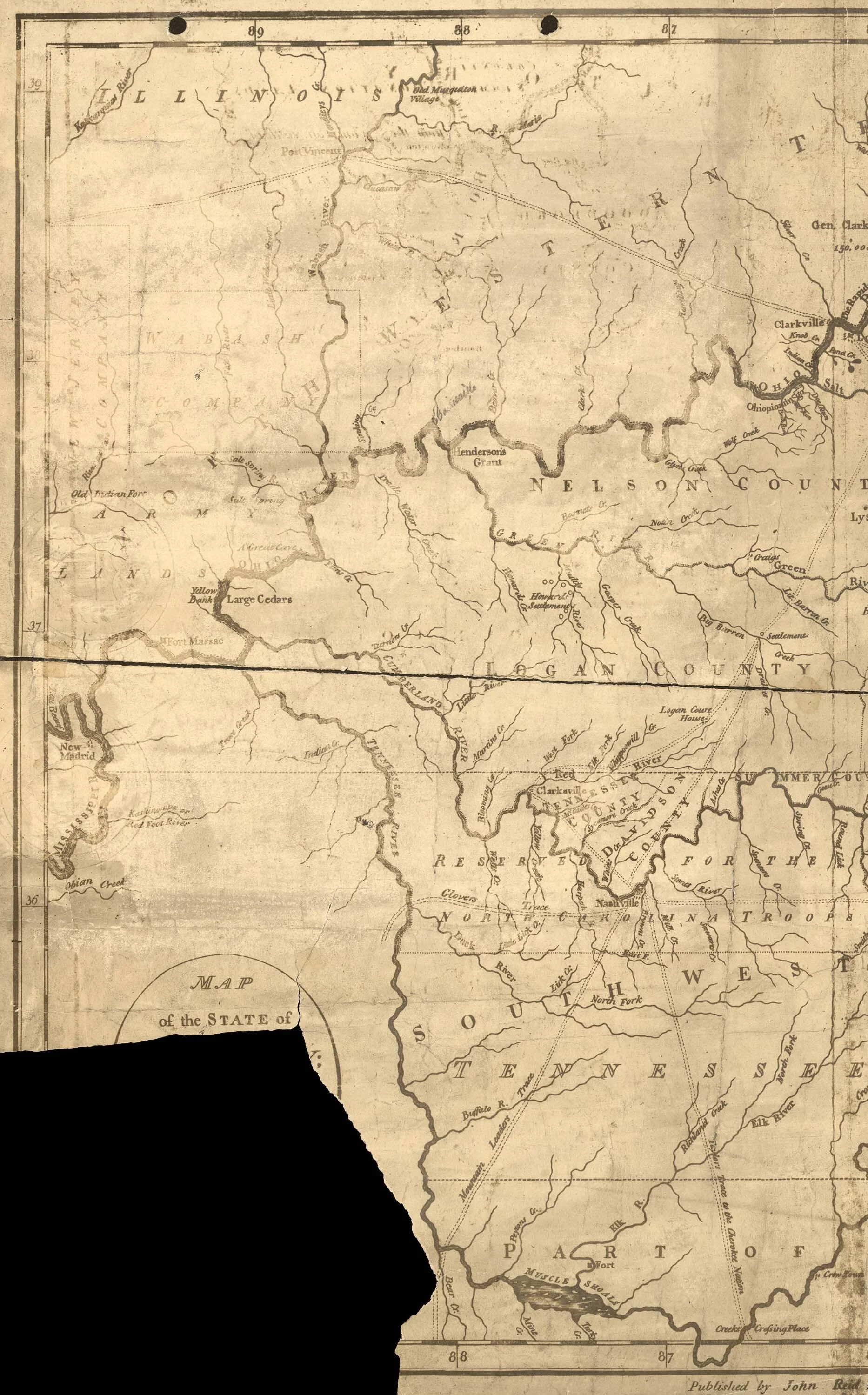
Mountain Leader’s Trace
This map shows the Cumberland River described in The Shadow of E. Z.’s Fear (as well as the Ohio, Mississippi, and Tennessee rivers. “Mountain Leader’s Trace” is shown in a general location from Nashville to present-day Waterloo, Alabama and Eastport, Mississippi, about five miles west of the later 1801 Columbian Highway and present-day Natchez Trace Parkway. Chickasaw Chief George Colbert, who along with his brother Levi Colbert operated a ferry at the Waterloo-Eastport crossing , persuaded the government to move the road eastward. Note also the “Glover’s Trace,” named after Chickasaw Chief Glover, leading from Nashville westward across the Tennessee River and then south along the old Chickasaw peace path that was also called “The Natchez Trace.”